
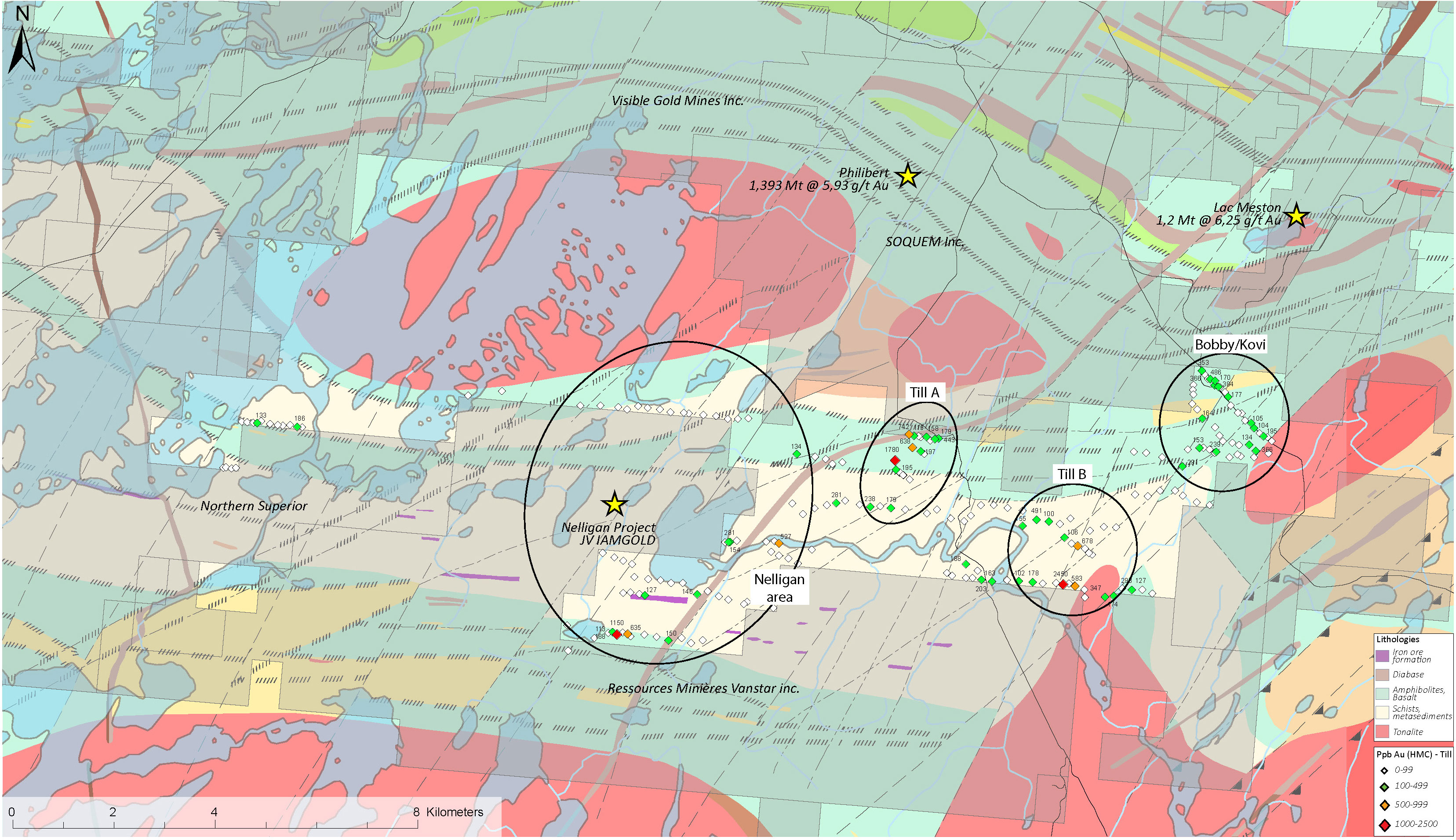
The project resides in the Archean Abitibi Sub-Province of the Superior Province. Locally, the property covers the metasediments of the Caopatina Formation, the volcanites of the Obatogamau Formation and the tonalitic intrusive of the Hazeur Pluton. These rocks were sheared and altered along the Opawica-Guercheville deformation zone, a well-recognized gold-bearing structure.
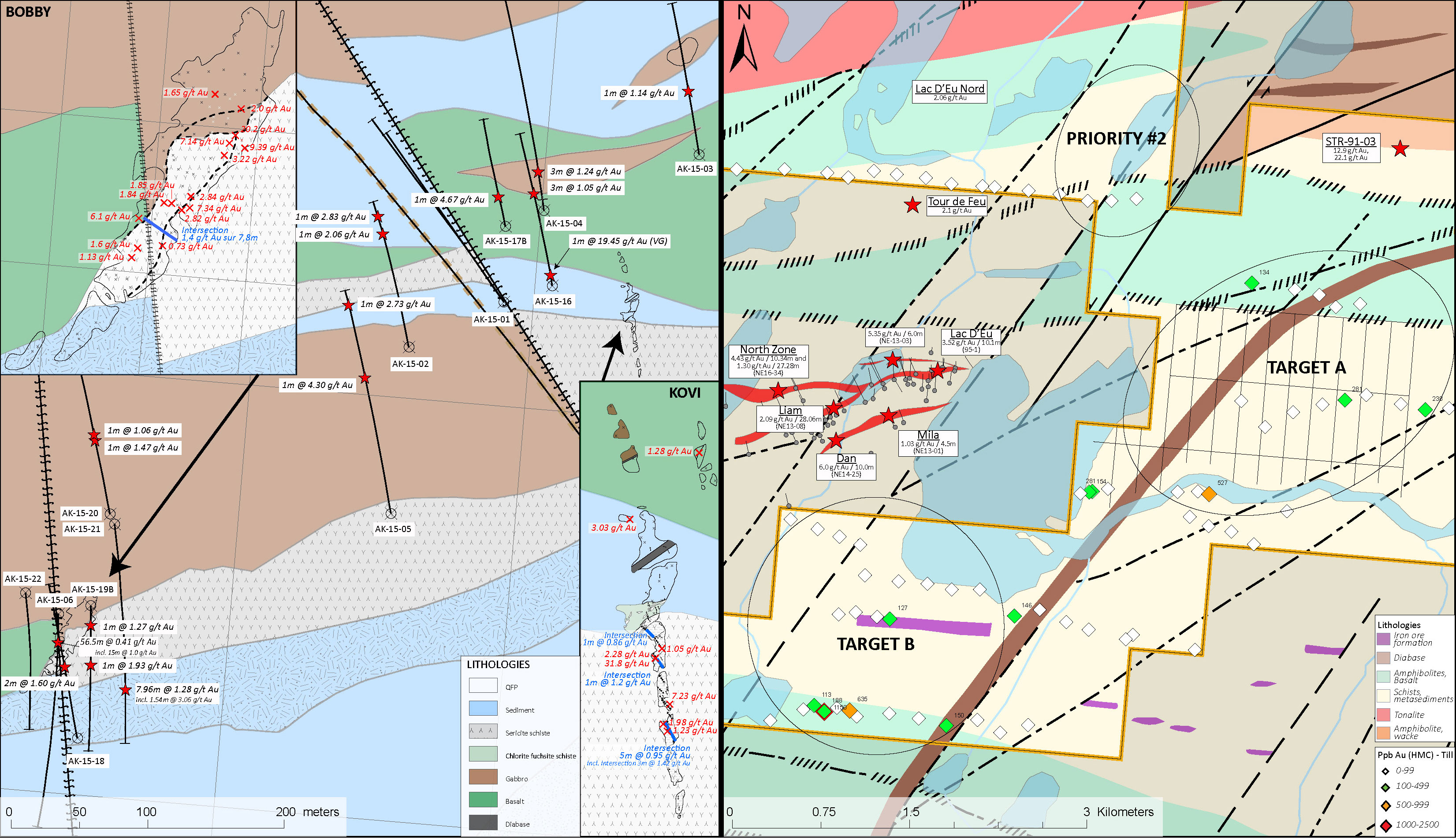
Known mineralization resulting from past exploration works included numerous gold showings located within the current limits of the Anik Property. Recent exploration concentrating within the northeast corner of the Property resulted in the broad definition of a continuous gold zone that can be connected from surface exposure to drill intercepts, such as the Bobby occurrence which returned two intercepts of 0.41g/t Au over 56.5 m and 1.28 g/t over 7.96 m at respective depths of 25 m and 110 m below the surface gold zone.
Anik Au
Geology
Maps
- In the Opawica-Guercheville deformation corridor
- Green schist to amphibolite metamorphic facies
- 4 to 20 km from several gold projects and mines (Joe Mann Mine, Lac Meston, Phillibert, Monster Lake, Murgor, Nelligan, etc…)
BOBBY KOVI AREA
Discovered in 2014
22 drill holes for a total 4,800m (winter 2014‐2015). 11 drill holes intersected the
mineralization identified in the showings.
BOBBY (5 DH, 650 m):
• 15m @ 1.0 g/t Au (ANK‐14‐6)
• 7.96m @ 1.28 g/t Au (ANK‐15‐21)
• 7.8m @ 1.4 g/t Au (channels, summer 2015)
• 11 samples (15‐40 cm channels) 1.65 to 9.39 g/t Au
• 19.3 g/t Au grab sample
KOVI (surface discovery 2015, 0 m drilled):
• 5m @ 0.95 g/t Au (channel)
• 4 samples (15‐35 cm channels) 1.8 to 7.23 g/t Au
• 31.8 g/t and 5 samples between 1.05 and 2.28 g/t Au (grab samples)
10m wide gold zone hosted within a sedimentary unit
• Sericite, ankerite and fuchsite alterations
• Pyrite and pyrrhotite (<10%) and arsenopyrite (<3%)
• 50m SE of ANK‐15‐16 (1m @ 19.45 g/t +VG in the sedimentary unit in the
beginning of the drill hole)